Situation Summary
Iceland remains a low-threat jurisdiction (rank #68 globally, composite score 28) with no tracked systemic instability. However, the Capital Region has experienced a cluster of violent crime incidents in the past week—armed robbery, edged-weapon assault, and a fatal stabbing—alongside active police monitoring of foreign-funded disinformation tied to an EU referendum held on 29 August. Natural hazards including rainfall-induced terrain instability and seismic activity in the southwest continue to present concurrent duty-of-care risks. The threat trajectory is stable but requires targeted Capital Region monitoring.
Key Developments
- Capital Region, 29 August: Fatal stabbing in Kársnes, Kópavogur; investigation described as extensive with suspects believed to be outside Iceland. Large-volume evidence collection ongoing; no wider public-safety threat indicated at present.
- Capital Region, 23 August: Armed pharmacy robbery in central Reykjavík involving vehicle-into-storefront incident; investigation ongoing with no casualties. Same-day edged-weapon assault (brass knuckles and bladed weapons) in central Reykjavík resulted in one hospitalization and three arrests.
- Capital Region, 25 August: Multiple arrests made following break-in and burglary at Dalsbú mink farm (Mosfellsdalur, near Reykjavík); investigation ongoing.
- National, 29 August: Advisory referendum on EU accession negotiations held nationwide. Police intelligence monitored active fake social-media accounts, opaque websites, and suspected foreign funding tied to referendum-related influence operations; no reported civil disorder or polling-day incidents.
- Southwest Iceland, 28 August: Icelandic Meteorological Office confirmed small earthquakes (including near Bárðarbunga) within last 48 hours; routine tectonic activity consistent with regional baseline.
- Reykjanes Peninsula, 30–31 August: Unconfirmed rescue operations at Reynisfjara and helicopter callout to Hafnarfjall reported by RÚV; insufficient detail available to classify as security or natural-hazard incident. Requires verification.
Highest-Risk Areas
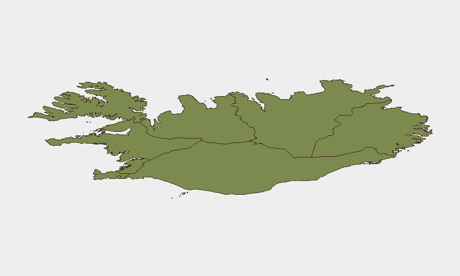
The Capital Region drives 86% of tracked risk (score 24) and concentrates five of seven recent crime events, including armed robbery, violent assault, and the fatal stabbing. The Southern Peninsula (risk 12) and Southern Region (risk 11) represent secondary concerns, though recent incidents there are limited to natural-hazard warnings (rainfall, terrain instability). Remaining regions show minimal activity. The Capital Region's concentration of firearm-involved and edged-weapon incidents, combined with confirmed disinformation activity and ongoing investigations, warrants elevated corporate monitoring for staff and asset protection in Reykjavík and suburban municipalities (Kópavogur, Mosfellsdalur).
How GeoBit Would Assist
Security teams should deploy AOI Monitoring & Early Warning focused on the Capital Region to track emerging crime clusters and police activity in real time. Election Monitoring and Network & Actor Analysis capabilities enable tracking of foreign-funded disinformation and suspected bad-faith social-media operations ahead of any follow-on political events. Intel Sweep and multi-language OSINT (including Icelandic media, police statements, and Telegram/X chatter) provide rapid confirmation or clarification of incidents—as currently needed for the unverified Reykjanes rescue operations—and support duty-of-care reporting to travelers and on-site personnel.
7-Day Outlook
No escalation in violent crime is anticipated; the recent Capital Region incidents appear investigatively contained and do not signal systemic breakdown. Seismic and weather-related hazards will persist as localized duty-of-care risks, particularly in the southwest and Reykjanes areas. Monitoring should focus on police charging outcomes, disinformation activity post-referendum, and any signal of organized criminal coordination in the Capital Region.
Highest-Risk Areas — Ranked
| # | State / Region | Risk |
|---|---|---|
| 1 | Capital Region | 24 |
| 2 | Southern Peninsula | 12 |
| 3 | Southern Region | 11 |
| 4 | Eastern Region | 10 |
| 5 | Western Region | 9 |
| 6 | Westfjords Region | 8 |
| 7 | Northwestern Region | 7 |
| 8 | Northeastern Region | 6 |
Sources
Previous Daily Briefs
A new Iceland brief is written every day — each with its own risk map and downloadable CSV. Here's the last week; use the calendar to go further back.
- August 30, 2026
- August 29, 2026
- August 28, 2026
- August 27, 2026
- August 26, 2026
- August 25, 2026
- August 24, 2026
📅 Browse every day by calendar →
Highlighted days have a brief. Tap a day for that day's map & analysis, or “csv” for that day's dataset ($5).
Atlas — our AI intelligence desk — emails them this snapshot personally. Nothing else, no list.