Situation Summary
Iceland remains a very low-threat environment with a global ranking of #73 and a composite threat score of 28. The Capital Region (Reykjavík area) carries the highest sub-national risk, driven primarily by isolated incidents of interpersonal violence and petty crime rather than systemic instability. The past week saw transport disruptions and one air-transport labor action, but no security events materially affecting corporate operations or duty-of-care obligations. The trajectory remains stable.
Key Developments
- Jökulsárlón, Route 1 (Southeast) — September 27–28: The Ring Road beside Jökulsárlón Glacier Lagoon closed from 20:00 on September 27 to 07:00 on September 28 for paving and bridge-end repairs on Breiðamerkursandur. No detour was available; one controlled passage window was scheduled at 22:00. This affected transit through the Southern Region.
- Kaldbaksvík, Westfjords (Strandir/Árneshrepp) — September 25–26: A large landslide crossed the road following heavy rain, isolating Árneshrepp. Authorities assessed travel as unsafe during continued rainfall; four-wheel-drive-only access was expected after clearance. Road access into the Northwestern and Westfjords regions remained compromised.
- Keflavík and Reykjavík airports (Capital Region) — September 23: The Icelandic Aircraft Mechanics Association initiated an indefinite strike at midnight, canceling 26 international and 5 domestic flights and affecting approximately 5,500 passengers. The strike was subsequently ended following government intervention, restoring normal operations within 24 hours.
- Eiðistorg, Seltjarnarnes (Capital Region) — September 25: Police responded to a knife-related incident and deployed a Taser. Details on injuries or arrests remain limited in available reports.
- Breiðholt (Capital Region) — September 21: Police responded to a vehicle fire, which fire services extinguished without difficulty. The vehicle was removed by crane truck; no injuries reported.
- Background context (September 17–18, prior week): A swimming coach assault outside ÍSÍ headquarters (Engjateigur, Capital Region) and a series of summer farm break-ins, including an arrest in Kjalarnes, underscore localized property and interpersonal-violence patterns concentrated in and around Reykjavík.
Highest-Risk Areas
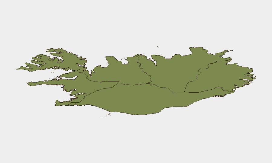
The Capital Region (risk score 24) accounts for the majority of tracked security events and remains the primary focal point for corporate security attention. Incidents cluster in Reykjavík and immediate suburbs (Breiðholt, Seltjarnarnes, Kjalarnes) and involve interpersonal violence, petty crime, and vehicle incidents rather than organized threats. The Southern Peninsula and Southern Region (risk scores 12 and 11 respectively) see lower event density but face geographically driven transport risks—landslides, road closures, and weather-dependent access—particularly in remote areas like Árneshrepp. Eastern, Western, and northern regions register minimal security concern.
How GeoBit Would Assist
Teams with personnel or assets in Iceland should employ AOI Monitoring & Early Warning on the Capital Region to track clustering of violence and property crime. Routing & Network Analysis capabilities are operationally critical for teams moving personnel via Route 1 or accessing western/northern regions; persistent monitoring of road-closure alerts, weather triggers, and seasonal geohazards (landslides, snow, flooding) reduces duty-of-care exposure. Multi-language web research and OSINT fusion provide early corroboration of transport disruptions and labor actions affecting airports and logistics.
7-Day Outlook
The planned Ring Road closure on September 27–28 has likely concluded, and airport operations have normalized after the mechanics' strike. Westfjords access may remain degraded if heavy rain persists; personnel routing should account for four-wheel-drive requirements or delays. No escalation in security-relevant threats is anticipated, and the operating environment for corporate teams remains permissive.
Highest-Risk Areas — Ranked
| # | State / Region | Risk |
|---|---|---|
| 1 | Capital Region | 24 |
| 2 | Southern Peninsula | 12 |
| 3 | Southern Region | 11 |
| 4 | Eastern Region | 10 |
| 5 | Western Region | 9 |
| 6 | Westfjords Region | 8 |
| 7 | Northwestern Region | 7 |
| 8 | Northeastern Region | 6 |
Sources
Previous Weekly Briefs
A new Iceland brief is written every Monday, covering the week — each with its own risk map and downloadable CSV. Use the calendar to go further back.
- September 22, 2026
- September 15, 2026
- September 8, 2026
- September 2, 2026
- September 1, 2026
- August 31, 2026
- August 30, 2026
📅 Browse past briefs by calendar →
Highlighted days have a brief. Tap a day for that day's map & analysis, or “csv” for that day's dataset ($5).
Atlas — our AI intelligence desk — emails them this snapshot personally. Nothing else, no list.